
06 Nov 2025
This article was first published in 2022. We’ve since analysed new data to update the map and statistics presented below. We’ll aim to update this article again when new data becomes available in autumn 2026, subject to time constraints.
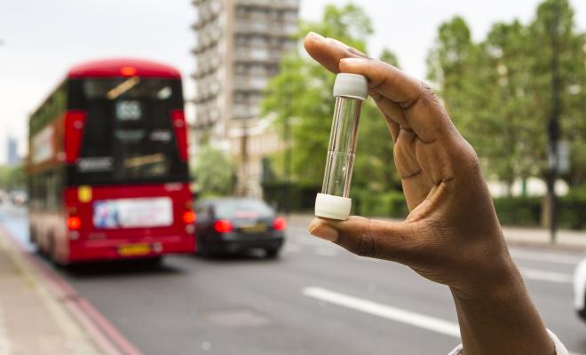
Air pollution poses a serious threat to lives and livelihoods
It costs the UK around 30,000 lives and tens of billions of pounds every year. It’s one of the UK's biggest killers and is seriously detrimental to our health, from causing lung cancer and worsening asthma symptoms to triggering heart attacks and strokes. Dirty air also creates a massive burden on health services and business – the costs of illness, lost workdays and premature deaths are estimated to be at least £27 billion a year and could be as high as £50 billion when wider impacts, such as dementia, are taken into account.
Friends of the Earth has used government data to identify those neighbourhoods across England and Wales exposed to levels of air pollution above World Health Organisation (WHO) levels and also the neighbourhoods where air pollution is double the level that WHO recommends. We’ve identified how many schools are in these neighbourhoods, as children are particularly susceptible to dirty air. Our analysis shows the unfair and disproportionate impact on people of colour and people on low incomes. We’ve also outlined some actions the government and local authorities must take to ensure clean air for all.
The analysis uses 2022-2024 data – the latest available – using a 3-year average to account for annual variations. The modelling calculates averages across neighbourhoods, which means there may be locations within some neighbourhoods where pollutant levels are higher, such as by busy roads. The neighbourhoods are small areas with an average population of around 1,500 people.
Progress is being made but low-income neighbourhoods suffer most
Over the last 10 years air pollution emissions have fallen by over a third (40% for NO2 and 36% for PM2.5) and the number of neighbourhoods with air pollution levels double that of current WHO guidelines for one or both of these air pollutants limits has reduced by 93%.
But behind these positive figures lies a story of environmental injustice, as pollution is increasingly concentrated in low-income neighbourhoods with low car ownership, and a high proportion of people of colour. Of the 5% of neighbourhoods (1.847) that still have air pollution double the WHO recommended level for one or both these pollutants,48% are in bottom third for income, half the population is people of colour compared to an average of 18% across England and Wales, and the majority (60%) don’t drive (road transport is the primary cause of NO2 pollution). The concentration of pollutant NO2 has fallen more slowly in these neighbourhoods than other areas (35% compared to 41%).
It’s striking that 10 years ago the neighbourhoods with very high air pollution had populations broadly in line with average demographics. So what has changed?
The figures alone can’t tell us why this deep environmental injustice has unfolded. Is it a consequence of cheaper housing in more polluted areas? Has there been greater policy action to reduce air pollution in wealthier areas with a greater proportion of white people? Or is it just chance? The data is suggestive and air pollution in low-income neighbourhoods is an issue that demands deeper research.
What causes air pollution and what harm does it do?
Air pollution is currently the biggest environmental threat to health in the UK, with up to 30,000 premature deaths estimated to be attributed to it in 2025, according to the Royal College of Physicians.
Our research looked at the 2 most damaging pollutants from a human health perspective – particulate matter (PM2.5) and the toxic gas nitrogen dioxide (NO2). Wood burning, industrial processes and road traffic, including non-exhaust emissions, are the major sources of particulates. Road transport is the primary source of NO2, particularly from diesel vehicles.
Particulates – tiny particles measuring 10 μm or less (PM10), or even smaller particles measuring 2.5 μm or less (PM2.5) – are known to reduce life expectancy, predominantly from cardiovascular and respiratory diseases. Particulates also cause lung cancer and may have wider impacts such as dementia. PM2.5 emissions are of particular concern because these particles can enter the bloodstream and be transported around the body, lodging in critical organs. This can seriously impact health, especially in vulnerable groups such as the young, the elderly and those with respiratory problems.
NO2 is a respiratory irritant that can cause inflammation of the airways and lead to coughs, mucus and shortness of breath. Studies have shown that NO2 is associated with reduced lung growth and respiratory infections in early childhood and affects lung functioning in adulthood.
Which neighbourhoods are most polluted by dirty air?
Using the latest government data from 2022-2024 on background air pollution, Friends of the Earth has identified the average annual level of these 2 air pollutants (PM2.5 and NO2) in every neighbourhood across England and Wales. From this, we’ve determined the number and location of neighbourhoods that breach WHO guidelines.
We’ve also identified which areas have “very high air pollution” – those with double the level recommended by WHO for one or both NO2 and PM2.5. There are 1,847 neighbourhoods with very high pollution.
Consult our interactive map to see how air pollution fares in your area.
Interactive map of air pollution across every neighbourhood across England.
Table 1 below identifies the number of neighbourhoods with very high air pollution grouped by local authority area. Over 90% of these neighbourhoods are in London. This doesn’t mean that other areas don’t have an air pollution problem – 95% of neighbourhoods in England and Wales are above WHO guidelines for PM2.5 or NO2. Instead, we’re simply highlighting the 1,847 neighbourhoods where air pollution is the worst.
In 5 of London’s local authority areas, all neighbourhoods have very high air pollution. Our research also found that 213 (4.3%) neighbourhoods in London have twice the recommended level of both NO2 and PM2.5.
Table 1 – Number and proportion of very high air pollution neighbourhoods grouped by local authority area
See the complete spreadsheet for data on all local authorities.
Air pollution limits
The UK previously derived its air pollution limits from the European Union (EU) – these were transposed into UK law and still apply. In the past, the government has been found guilty in the courts for failing to comply with the current legal limit – measured as an annual average – for NO2 (40 µg/m3). According to the latest government compliance report, the UK is still failing to meet this limit in 5 of the 43 areas it’s identified for air quality assessments (UK Air Quality Zones), when all areas should have met this since 2010.
Now we’ve left the EU, the government has set new legal limits, although only for PM2.5 where it’s proposed an improved limit of 10 µg/m3 by 2040. It’s maintained the legal limit for NO2 at 40 µg/m3. However, WHO’s guidelines are more stringent – since September 2021 it’s recommended an annual average of 5 µg/m3 for PM2.5 and 10 µg/m3 for NO2.
Although we view neighbourhoods with double WHO’s guidelines for at least one of these pollutants as having very high air pollution, UK limits are so lax that levels of even more than double WHO’s guidelines wouldn't breach UK law.
Who fares the worst?
Our analysis shows that air pollution disproportionately impacts lower income and more deprived areas - and particularly affects neighbourhoods with higher ethnic minority populations. Half of neighbourhoods (48%) that have very high air pollution are in the bottom 30% of the most income-deprived neighbourhoods. And half (50%) of the population in neighbourhoods with very high air pollution are people of colour. In contrast, across neighbourhoods in which both pollutants are below WHO guidelines, only 3% of the population are people of colour and only 16% are income deprived.
There’s also a disparity between those creating the pollution and those most impacted by it. For example, households in neighbourhoods with very high air pollution – mostly due to traffic travelling through the area - are over 4 times less likely to own a car than those in the least polluted areas.
Approximately 600,000 children, of which two-thirds are under 12, live in areas where NO2 or PM2.5 (or both) is double WHO guidelines. There are 1,234 schools in these neighbourhoods.
See Table 2 below for more details. We’ve identified how demographic indicators map across neighbourhoods with different average annual concentrations of either NO2 or PM2.5 (or both), including how these relate to WHO guidelines.
Table 2 – Neighbourhoods with different levels of air pollution grouped by demographic indicators
Note: the total number of neighbourhoods across the 3 air pollution columns is greater than the total number of neighbourhoods in England and Wales overall. This is because there's some overlap between neighbourhoods in the last 2 columns.
What are the solutions?
Action is needed from every tier of government to tackle the sources of all key pollutants – not just to comply with current UK requirements on air pollution, but also to achieve WHO guidelines as soon as possible. Friends of the Earth is a founder member of the Healthy Air Coalition which is campaigning for a number of solutions. Solutions include:
The UK government must update its legal limits for air pollution in England, with interim targets by 2030. The limits should be 10 ug/m3 for PM2.5 by 2030 and 5 ug/m3 as soon as possible after that, and 20 ug/m3 for NO2 by 2030 on the path to 10 ug/m3. In Wales, the government has introduced a new Clean Air Act, which requires ministers to set a target for PM2.5 by January 2027 and enables them, but doesn’t require them, to set a target for NO2. They should set a target for NO2.
More must be done on transport, including cutting vehicle use. Research for Friends of the Earth outlines how to cut car use significantly, including through encouraging cycling and walking.
In England, local authorities have an important role, for example through setting up Clean Air Zones to restrict the dirtiest vehicles in areas of high air pollution, constraining traffic near schools and providing alternatives to car use such as better buses and segregated cycleways.
- Other sources of air pollution must also be tackled, for example via measures that constrain domestic wood burning, particularly in urban areas.
Given its serious health and societal ramifications, tackling air pollution must be a priority for the government and local authorities. The unfair and disproportionate impacts of air pollution must be urgently addressed, to enable all neighbourhoods to enjoy the benefits of clean air, whatever their demographic.
Methodology and data sources
The modelling of air pollution by neighbourhoods (LSOAs) used Defra’s modelled background pollution data published at 1x1 km resolution. This was aggregated to neighbourhoods on an area-weighted basis using LSOA 2021 boundaries. Because the annual data is also subject to annual variations due to weather, particularly unusual wind patterns, we are using a 3-year moving average using the latest 3 years of data (2022-2024).
Pollution concentrations for PM2.5 and NO2 were compared with WHO guidelines. Neighbourhoods were categorised based on the extent to which air pollution levels exceeded these guidelines.
Additional socio-economic and demographic data available at the neighbourhood level on schools, child population, ethnic minority (people of colour) population, income deprivation, and car ownership were appended to the data set. This was used to derive national, regional, and local authority summaries.